Printable Maps
africa
americas (north and south)
antarctica
arctic
asia
australia
australia (political borders)
australia (states and territories)
canada
caribbean
central america
eurasia
europe
great lakes
latin america
latitudes/longitudes
middle east
north america
oceania
south america
southeast asia
tsunami map - december, 2004
usa (48 states)
usa (48 states) (mercator projection)
usa (50 states)
usa (50 states) (full state names)
usa (50 states) (mercator projection)
usa (continental shape only)
world (mercator with borders)
world (mercator with borders) (except no borders for canadian provinces and usa states)
world (mercator with antarctica)
world (mercator - pacific centered)
world (pacific centered no borders)
world (mercator no borders)
world (mollweide projection)
world (continent borders only)
Map Test
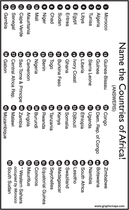
AFRICA name the countries, and the answers
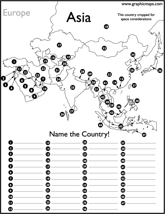
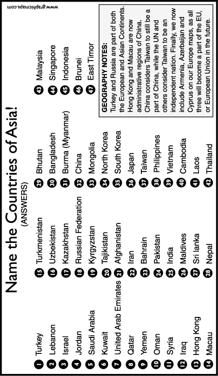
ASIA name the countries, and the answers
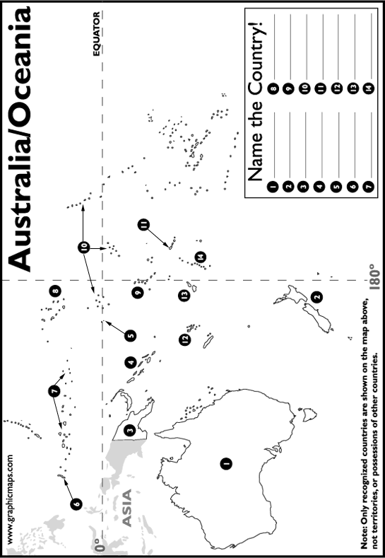
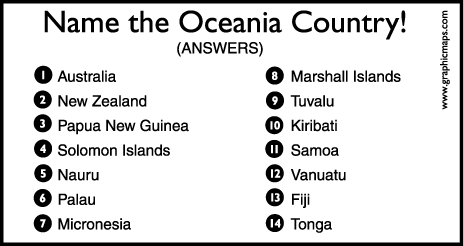
AUSTRALIA/OCEANIA name the countries, and the answers
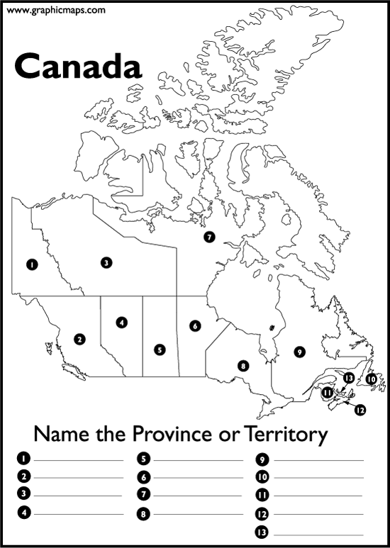
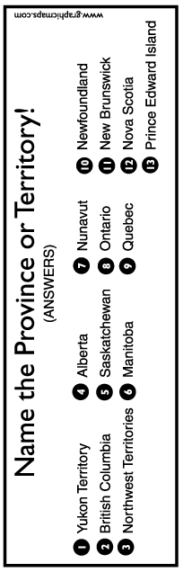
CANADA name the provinces and territories, and the answers
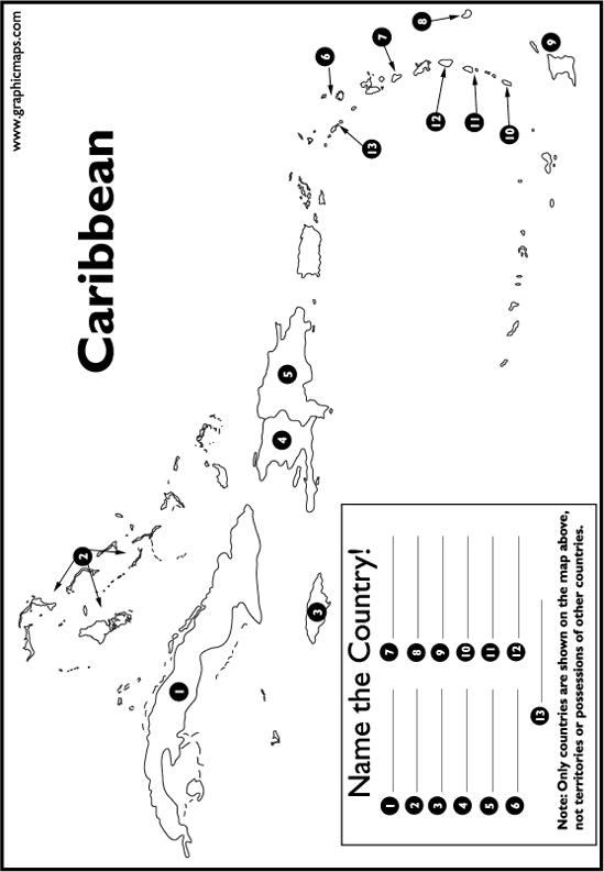
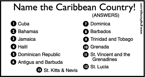
CARIBBEAN name the island countries, and the answers
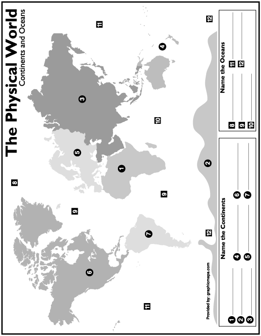
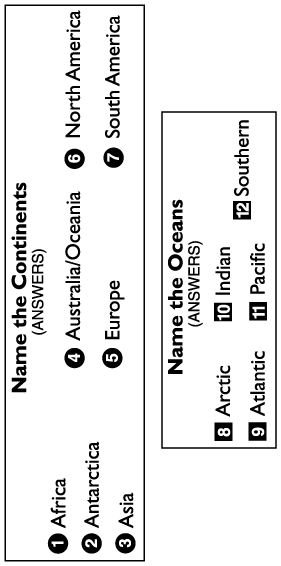
CONTINENTS and OCEANS name them, and the answers
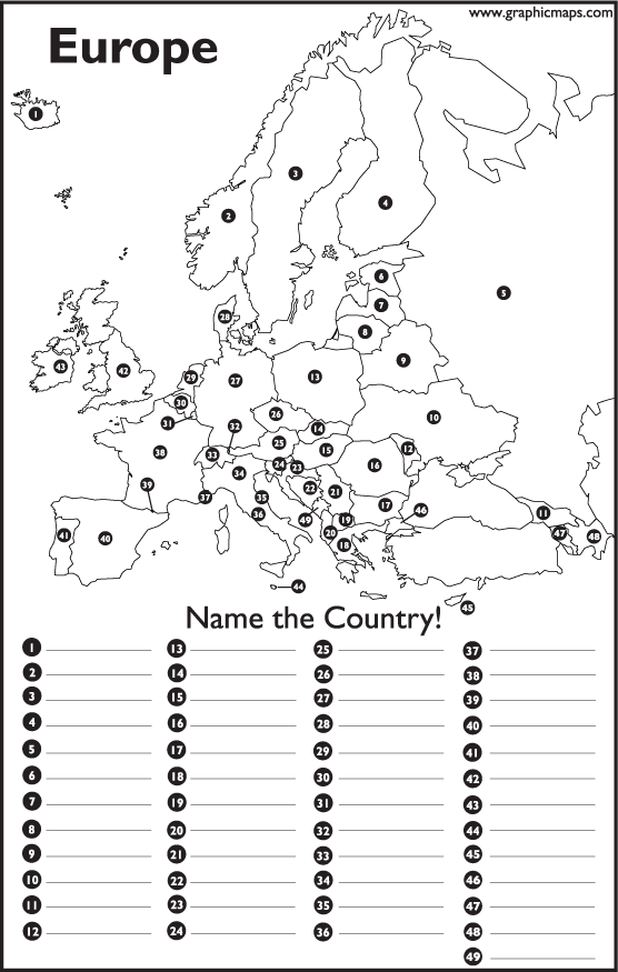
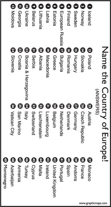
EUROPE name the countries, and the answers
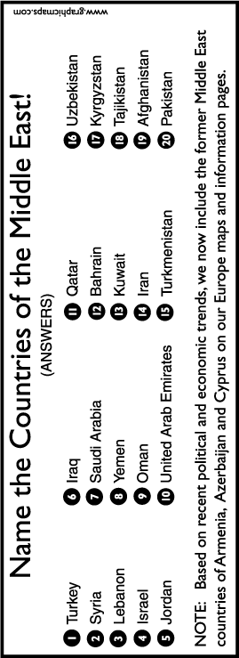
MIDDLE EAST name the countries, and the answers
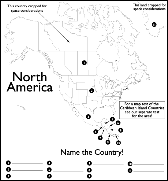
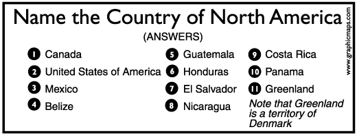
NORTH AMERICA name the countries, and the answers
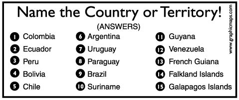
SOUTH AMERICA name the countries, and the answers
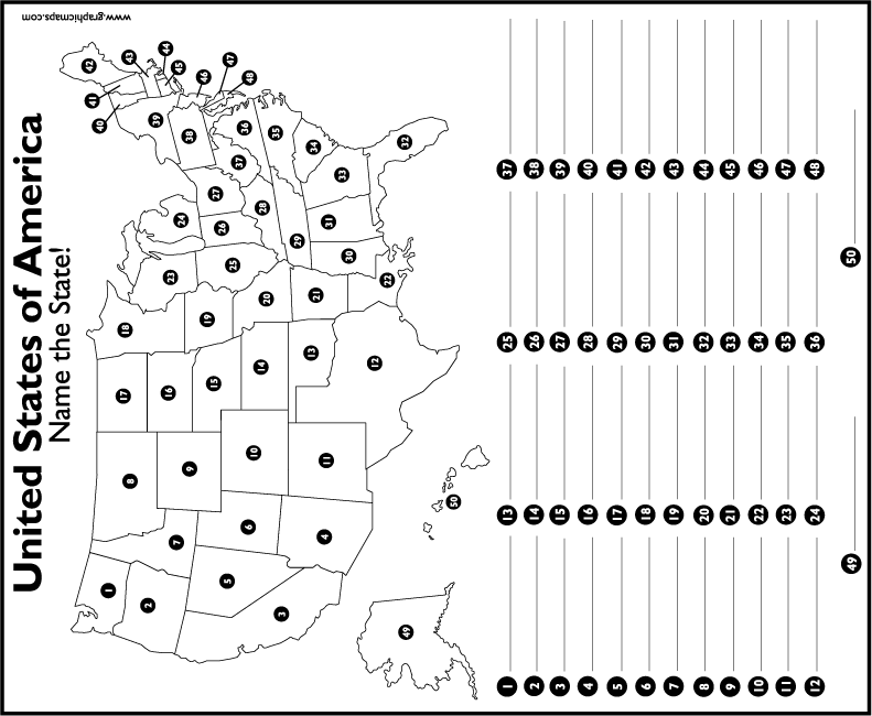
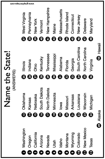
USA STATES name them, and the answers
USA CAPITAL CITIES name them, and the answers
